- Joined
- Aug 9, 2007
- Messages
- 12,967
I must say that this trip was a bit of a surprise. I've been putting off Fiftymile Creek for years. Always on the to-do list but never getting done. It always seemed too short, or perhaps not interesting enough to bring along friends who don't get out as often as I do.
But after having to cancel my Grand Canyon backpackaneering trip, I was determined to do something cool to make up for it. Our original plan was for the Trachyte Creek area, but after checking the water levels in Lake Powell, I realized now was the perfect time to get into Fiftymile. Rumor has it that there are incredible narrows hidden below the typical lake levels and I wanted to see them.
We had a three day weekend to kill however, and Fiftymile didn't seem big enough to satisfy that so we decided to do two back-to-back overnight trips. For the first half of the trip it would be just colefeet and I. The next day we would hike out and meet Ndheiner for the second leg.
We camped out the first night at a nice new spot we found late on Thursday night. I didn't really take any pictures but it was near a spring and wow did it have a huge cottonwood growing there. Easily the largest cottonwood I've ever seen by 3-4 times. After a nice night around the fire, we were up early and packing up to hit the trail. The plan for the day was to hike in to the upper part of the riparian zone, setup camp, then day hike the lower part of the canyon.
Here is a map with my GPS tracks for the hike:
View larger map.
The hike starts off from Hole-in-the-Rock Road just below the sculpted alcoves of Cave Point. After a half hour or so, we reached a dry fall that we bypassed on the left LDC, passing a really nice looking slot before finding our way back down into the canyon bottom with a bit of steep but easy scrambling. The next couple of miles were dry but still pretty interesting as the canyon wound it's way closer to Fiftymile Creek.
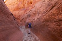
Once at the confluence with Fiftymile, it didn't take long before the first flowing water appeared. Then, around the next bend, it was like a gateway of cottonwoods welcoming us to paradise. Hard to see in this photo, but this corridor was lined with cottonwoods in a near perfect line on the left. It was so perfectly straight and evenly spaced that it was almost hard to believe that someone hadn't deliberately planted each one as carefully as a landscaper would.
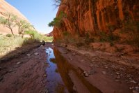
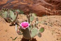
Wandering along, I see a prickly pear! Oh, and whats that on the wall in the background?
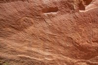
Several good panels of petroglyphs that I had no idea where there!
A little further down, we came upon the arch. I've seen photos of this and pretty much nothing else in Fiftymile. We decided to head over to the alcove on the right to have lunch.
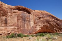
And whats this all over below the arch? Pretty hard to photograph in the direct light. It also looked a lot better with polarized sunglasses. There was a ton of art here. Some of it pushing 30 feet off the ground on a sheer wall.
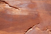
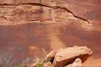
We decided our lunch alcove would make a nice campsite so we dropped off our things and continued down canyon. Much of the upper canyon is a delightful riparian zone with nice undercuts and beautiful varnished walls.
Soon enough the canyon closed in on us as we meandered through it's depths.
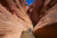
After passing a huge beaver dam, we found ourselves at the top of a beautiful waterfall that funneled the creek into a tiny chute as it poured down into an intriguing channel. We're below the full pool elevation of Lake Powell at this point. If the lake were full, this would be gone.
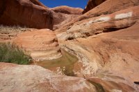
Continuing down canyon, the water got deeper and the narrows got narrower. I remember as we approached this section Jen thought we might have reached Lake Powell because it looked like a total swimmer. Turned out to be about stomach deep on me.
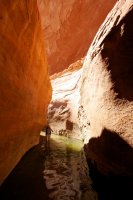
As we went deeper, the canyon just got better and better.
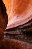
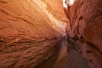
I hate to admit it, but those old Powell waterlines looked pretty cool in this undercut.
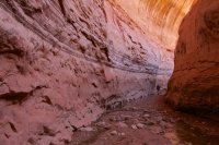
As if all that wasn't good enough, we soon found ourselves approaching an incredible subterranean section of the canyon. We're now way below typical lake level. This area, and likely much of the canyon above it would not typically be accesible even if the lake was 50-70 feet below full pool. Maybe more.
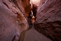
Looking up inside the dark narrows.
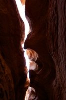
Jen approaching the light.
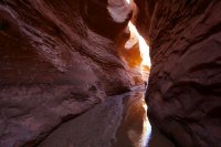
We took our time through that section, in awe of our surroundings. What we would hike through next would not be quite as inspiring. After a bend or two, the canyon opened up a bit more and into a waste land of decay. It felt like bull dozers had crashed through and destroyed the place.
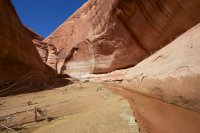
The undercuts were deep, the kind of stuff people rave about in Coyote Gulch. It's easy to imagine what incredible canyon this must have been before it was flooded. We made it around this deep cut and almost around the next before having to turn back. We didn't get to the lake, but the quicksand mud was getting really dangerous and we had seen enough.
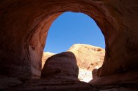
So back to my happy place...
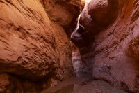
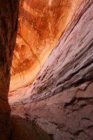
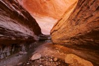
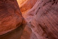
The late afternoon light on the hike back up canyon was just fantastic.
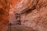
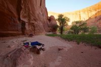
Back at our alcove camp relaxing with Jen's all-knowing medical emergency book. Want to learn how to treat a Sting Ray injury? Jen's your girl!
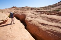
The next day we woke up and hit the trail right away. The plan was to hike the 3.5 miles out and head to Dance Hall Rock to meet up with Nate between 10-11 and do a little resupply before starting our next hike. Here's a shot of Jen checking out that little slot we bypass on the way in and out. Would have been fun to walk up into it if we'd had a bit more time.
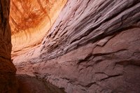
Featured image for home page:
But after having to cancel my Grand Canyon backpackaneering trip, I was determined to do something cool to make up for it. Our original plan was for the Trachyte Creek area, but after checking the water levels in Lake Powell, I realized now was the perfect time to get into Fiftymile. Rumor has it that there are incredible narrows hidden below the typical lake levels and I wanted to see them.
We had a three day weekend to kill however, and Fiftymile didn't seem big enough to satisfy that so we decided to do two back-to-back overnight trips. For the first half of the trip it would be just colefeet and I. The next day we would hike out and meet Ndheiner for the second leg.
We camped out the first night at a nice new spot we found late on Thursday night. I didn't really take any pictures but it was near a spring and wow did it have a huge cottonwood growing there. Easily the largest cottonwood I've ever seen by 3-4 times. After a nice night around the fire, we were up early and packing up to hit the trail. The plan for the day was to hike in to the upper part of the riparian zone, setup camp, then day hike the lower part of the canyon.
Here is a map with my GPS tracks for the hike:
View larger map.
The hike starts off from Hole-in-the-Rock Road just below the sculpted alcoves of Cave Point. After a half hour or so, we reached a dry fall that we bypassed on the left LDC, passing a really nice looking slot before finding our way back down into the canyon bottom with a bit of steep but easy scrambling. The next couple of miles were dry but still pretty interesting as the canyon wound it's way closer to Fiftymile Creek.
Once at the confluence with Fiftymile, it didn't take long before the first flowing water appeared. Then, around the next bend, it was like a gateway of cottonwoods welcoming us to paradise. Hard to see in this photo, but this corridor was lined with cottonwoods in a near perfect line on the left. It was so perfectly straight and evenly spaced that it was almost hard to believe that someone hadn't deliberately planted each one as carefully as a landscaper would.
Wandering along, I see a prickly pear! Oh, and whats that on the wall in the background?
Several good panels of petroglyphs that I had no idea where there!
A little further down, we came upon the arch. I've seen photos of this and pretty much nothing else in Fiftymile. We decided to head over to the alcove on the right to have lunch.
And whats this all over below the arch? Pretty hard to photograph in the direct light. It also looked a lot better with polarized sunglasses. There was a ton of art here. Some of it pushing 30 feet off the ground on a sheer wall.
We decided our lunch alcove would make a nice campsite so we dropped off our things and continued down canyon. Much of the upper canyon is a delightful riparian zone with nice undercuts and beautiful varnished walls.
Soon enough the canyon closed in on us as we meandered through it's depths.
After passing a huge beaver dam, we found ourselves at the top of a beautiful waterfall that funneled the creek into a tiny chute as it poured down into an intriguing channel. We're below the full pool elevation of Lake Powell at this point. If the lake were full, this would be gone.
Continuing down canyon, the water got deeper and the narrows got narrower. I remember as we approached this section Jen thought we might have reached Lake Powell because it looked like a total swimmer. Turned out to be about stomach deep on me.
As we went deeper, the canyon just got better and better.
I hate to admit it, but those old Powell waterlines looked pretty cool in this undercut.
As if all that wasn't good enough, we soon found ourselves approaching an incredible subterranean section of the canyon. We're now way below typical lake level. This area, and likely much of the canyon above it would not typically be accesible even if the lake was 50-70 feet below full pool. Maybe more.
Looking up inside the dark narrows.
Jen approaching the light.
We took our time through that section, in awe of our surroundings. What we would hike through next would not be quite as inspiring. After a bend or two, the canyon opened up a bit more and into a waste land of decay. It felt like bull dozers had crashed through and destroyed the place.
The undercuts were deep, the kind of stuff people rave about in Coyote Gulch. It's easy to imagine what incredible canyon this must have been before it was flooded. We made it around this deep cut and almost around the next before having to turn back. We didn't get to the lake, but the quick
So back to my happy place...
The late afternoon light on the hike back up canyon was just fantastic.
Back at our alcove camp relaxing with Jen's all-knowing medical emergency book. Want to learn how to treat a Sting Ray injury? Jen's your girl!
The next day we woke up and hit the trail right away. The plan was to hike the 3.5 miles out and head to Dance Hall Rock to meet up with Nate between 10-11 and do a little resupply before starting our next hike. Here's a shot of Jen checking out that little slot we bypass on the way in and out. Would have been fun to walk up into it if we'd had a bit more time.
Featured image for home page: